Alameda County - With a posse on their tails in 1893, two banditsallegedly buried a cache of stolen loot near a brick kiln at Adams Point on Lake Merritt. When the lawmen caught up with the outlaws, one was killed and the other immediately arrested. The surviving outlaw died later died in prison. The ill-gotten treasure has never been found. Contra Costa County - Dr. John Marsh, a California pioneer who was sometimes referred to as California's first American doctor, was allegedly known to bury his money near his home nestled in the foothills of Mt. Diablo. | 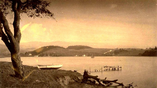 Lake Merritt from Adams Point, 1884, photo courtesy California Digital Archives. | ||||||||
| |||||||||

I'm changing the theme of my blog from gold prospecting too seeking gold! Any type of gold in other words any way we can make enough money to buy Gold or Silver
Saturday, January 29, 2011
More California Treasures Just Waiting To Be Found
Tuesday, January 25, 2011
ARIZONA LEGENDS
Flagstaff Trading Post - Due the many robberies during the 1800s, one owner of an Indian trading post named Herman Wolf, got in the habit of burying his profits in cans and jars around the fences on his property. Operating the trading post for thirty years on the Little Colorado River between 1869-1899, his highly profitable business brought him tens of thousands of gold and silver coins over the years. These treasure troves are said to have numbered in the hundreds of thousands and his thirty year accumulationestimated at $250,000. In 1901 twenty U.S. gold coins were found, and in 1966, a bucket of Mexican silver was discovered at the site. However, these two finds are but a small percentage of what was buried and the main cache remains to be found. The old store was located on the LittleColorado River River just off the California-Santa Fe Trail nearCanyon Diablo. | 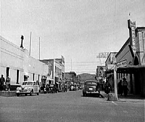 Flagstaff, Arizona in 1943 | |
| ||
Tuesday, January 18, 2011
More Missouri Treasures
Spanish Treasure in Cass County - On October 24, 1879 an article in the Cass County Times-Courier described the location of a hidden Spanish treasure near Harrisonville,Missouri. The text read:
"Before being massacred by attacking Indians in 1772, several hundred Spaniards buried 15 loads of gold averaging 130 pounds each and 1,000 bars of silver weighing an average of 20 pounds to the bar... in the area four or five miles west and one or one and one-half miles north of Harrisonville. The silver was buried within one-fourth of a mile of where the present day Rodman School is standing; the gold is three fourths of a mile farther northwest.”
More than fifty years later, a construction crew was building a bridge in 1930. The location was several miles southeast of the old Rodman School. During the excavation, the crew found evidence of a battle between the Spanish and the Indians, locating old weapons, skeletons, and part of old armor.
Harrisonville has dramatically grown in the last several years, so locating the exact location of the old Rodman School will, no doubt, require some sleuthing skills.
Reader Update: I live in Cass county, just north of Harrisonville and a little east of Peculiar, Missouri We have always heard the legend of the Spanish gold and have been told that it is on some land that we had when I was a child and I think mom and dad still own. My sister, brothers and I are going to hunt this weekend, weather permitting. There is an area that dad could never get any grass or anything to grow on. We will look there. Thanks for the research that backs the claims that we have always heard. - Teresa, October, 2004
Reader Update: I've been researching the "Harrisonville" legend and have found the "Rodham" school. I am planning on a trek this weekend to the area. I was viewing some of the maps online and found a topographic map and aerial photo of the area, approximately a 1/4 mile from Rodham school. On the aerial photo there appears to be a concentric ring that does not appear on the topo. I am still trying to find other aerial photos of the is area. See here: Treasurenet. For some reason this "legend" kind of gets my blood pumping. While the Spanish were in the area at the time, I would like to see if I could find records from the Spanish missions in the area. Perhaps they might hold more documentation of the massacre. I believe the Indian tribe was the Osage. I can't say for sure but that seemed to ring a bell. Perhaps some of the old Osage tribal leaders might have information about it. - From Rex, "Flatlander With Gold Fever," April, 2005
Outlaw Loot at Huzzah - About three miles out of Huzzah, Missouri is said to be a cache of stolen outlaw loot. The treasure was carried up a small hollow from Haunted Springs to a rock shelter, placed in a fox hole under the bluff and covered with rocks. At the time it was buried, the skull of a horse head was left as a marker. Huzzah, Missouri is approximately 100 miles southeast of Jefferson City, Missouri on Missouri Highway 8. More Spanish Treasure - Legends abound throughout the area of Noble Hill that a cache of Spanish treasure is buried in the area somewhere. Noble Hill, is about thirteen miles north of Springfield, Missouri on Missouri Highway 13 on the Polk-Greene County line. | |
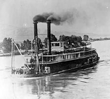 Kaffer Treasure - A cache of gold coins known as the Kaffer Treasure is said to be buried in the area of Armstrong, Missouri. Armstrong is about forty miles northwest of Columbia, Missouri. Kaffer Treasure - A cache of gold coins known as the Kaffer Treasure is said to be buried in the area of Armstrong, Missouri. Armstrong is about forty miles northwest of Columbia, Missouri.Sunken Treasure in the Mississippi - In the Mississippi River that runs along the banks of St. Louis, Missouri there were several steamships that went down in the river long ago. Some of these are said to be laden with gold coins. Hillary Farrington Loot - The outlaw Hillary Farrington was said to have buried a cache of loot on the Old Duram Farm at Jeona, Missouri. Independence Jewelry Heist - Sometime around 1927, $25,000 in jewelry and gems was taken by bandits who robbed an area jewelry store. Supposedly, the bandits were said to have buried the loot at the foot of an old oak tree between two large roots about six miles east ofIndependence. Now, for the difficult part. If the "six miles east of Independence" was back in 1927, this could be very difficult to find today as Independence, Kansas City and other small suburbs have virtually melded into one large metropolitan city. 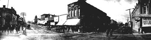 Independence, Missouri in the early 1900s, courtesy Heritage Museum Forty Niner Gold in Missouri - Long ago a Missouri man was said to have struck in rich in the gold hills of California. Returning to his home near Waynesville in Pulaski County, he was said to have buried $60,000 in the hills. Spanish Mine in the Ozark Hills - Three centuries ago, Spaniards worked mines in the Ozark Hills of Missouri. One of the mines containing lead and silver, eighteen miles southwest of Galena, was worked by seven men, who could not agree as to a division of the yield. One by one they were killed in quarrels until but a single man was left, and he, in turn, was said to have been killed by the ghosts of his previous victims. In 1873, a man named Johnson from Vermont went there, trying to find the old Spaniards' mine. He did work there for one day, and was then found dead at the mouth of the old shaft with marks of bony fingers on his throat. The exact location of the cursed mine remains unknown. - Submitted by Anthony, March, 2005 Enjoy the stories please follow us. Our websites see American made prospectors tools : |
Saturday, January 15, 2011
Bandit Hordes in California
Joaquin Murrieta was a legendary figure in California during its Gold Rush days of the 1850's. When he tried to make his living in mining, he faced racism and discrimination. Forced to turn to a life of crime, he was seen by some as as a Mexican patriot, resisting the white settlers' domination. Others saw him simply as a bandit. Murrieta became the leader of a band called The Five Joaquins, who were said to have been responsible for the majority of cattle rustling, robberies, and murders that were committed in the Mother Lode area of the Sierra Nevadas between 1850 and 1853. One of those robberies was a wagonload of gold that the Joaquins had stolen from the northern mines. However, when members of Murrieta's gang were driving the load along the hills east of the old Carrizo Stage Station they were ambushed by Indians. According to the tale, the gold, as well as other items taken from the gang, were hidden in an old burial cave under a projecting rock ledge. No doubt Murrieta would have soon gone after the lost loot, but he was killed by the California Rangers before he could retrieve the gold. The Old Carrizo Stage Station which once served the Butterfield Stage Station is located in the Anza Borrego Desert. |  Joaquin Murrieta, photo courtesy San Joaquin Valley Library System, California Digital Archives | ||
| |||
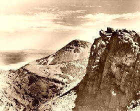 Eagle Peak in the Warner Mountains of California, photo courtesy | The vicious crime went unsolved for years until a Pitt RiverIndian known as "Holden Dick” began to trade small amounts of gold ore in Susanville and Alturas. In between appearing in the saloons of mining camps, spending his money freely, theIndian would disappear into some of the most rugged sections of the South Warner Mountains, only to return again with a goodly supply of gold ore. At first, the locals thought that the Indian was working a secret mine and when in the saloons, they would try, without success, to get the Indian to talk. They also began to follow Holden, hoping to find the mine. On one occasion, when another miner named Samuel B. Shaw was badgering theIndian for the location of his gold, Holden got fed up and shot the man, wounding him fatally. Holden Dick was soon arrested for Shaw’s murder and locked up in the Susanville jail. On January 23, 1886, four men stormed the jail and dragged the Indian into the street. Beating, whipping and torturing the man, he refused to tell the location of his hidden cache and was finally hanged at the blacksmith shop. | ||
Somewhere along the line, the authorities figured out that the gold ore so freely bandied about by the Indian did not come from a mine, but rather, was the stolen loot taken from the freight wagon some five years previously. After a little more "digging” the cache is believed to have been hidden in a cave where Holden Dick lived most of the time. The cave was located in one of the many canyons which extend from Eagle Peak on the western slope of the southern Warner Mountains. He was also said to have constructed a crude rock wall at the cave’s entrance, though today it would most assuredly be collapsed. It is most likely that the cave would be located in the lower elevations of the mountains since theIndian lived there year round. © Kathy Weiser/Legends of America, updated February, 2010. Hope you enjoyed the story see some American Made Prospectors. Click Texas Pete for PROSPECTORS TOOLS   Click here on Old GreatPaw for GOLDSEEKERSTOOLS Click here on Old GreatPaw for GOLDSEEKERSTOOLS | |||
Wednesday, January 12, 2011
Treasure Hunting Code of Ethics
Treasure Hunter - Code of Ethics
 Responsible hunting will keep the hobby alive for everyone else! Please follow the Treasure Hunter's Code of Ethics so that all of us can continue to enjoy this enjoyable hobby and perhaps, even get lucky and find our fortunes!.
- I will respect private property and will do no treasure hunting without the property owner's permission.
- I will fill in all holes I dig.
- I will not damage natural resources, wildlife habitats, or any private property.
- I will use thoughtfulness, consideration, and courtesy at all times.
- I will build fires in designated or safe places only.
- I will leave gates as found.
- I will remove and properly dispose of any trash that I find.
- I will not litter.
- I will not destroy property, buildings, or what is left of ghost towns and deserted structures.
- I will not tamper with signs, structural facilities, or equipment.
- And, finally, the most important one of all -- I will have fun!!
If we all follow these simple rules while metal detecting or treasure hunting, we will go a long way to keeping the public on our side in the fight to protect our rights.
Hope you get some use from these tips! please check out my websites for any tools you may need
And
Monday, January 10, 2011
Tips for Traveling in the Desert
| |||||||||||
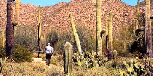
 Drinking Water – Carry at least one gallon per day/person of drinking water. Plastic containers work better than metal containers or water bags. While drinking water can be obtained at several places in desert parks, you cannot rely on this, as some water sources must be purified before it is suitable to drink. If you are relying on a spring that is listed on a map, when you arrive there, it might be dried up. In fact, it’s probably a good idea to follow the minimum guidelines for one gallon/person/day, but it wouldn’t hurt to have a little extra. Don’t ignore this guideline if you’re just traveling across the desert by car. Any number of things could happen and you need to have a stocked up water supply.
 Sun and Heat Exposure – In the desert, you just need to avoid exposure to the sun at all costs. Sunburns can be very serious, and and heat stroke or heat exhaustion can prove fatal. It is advisable to wear a hat, sunscreen and dark sunglasses. Even though it’s hot, plan on wearing light, loose long sleeve shirts and long pants. Remember to reapply sunscreen periodically to any exposed areas. Time your walking in the early morning and late afternoon when the sun is not as intense.
 Beware of the Hantavirus – While there is no evidence to suggest that travel should be restricted in the desert, there have been several reports of the disease in the deserts of the American West. Listed below is a list of useful precautions:
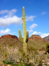
Friday, January 7, 2011
Canyon Diablo - Meaner Than Tombstone
ENJOY THE STORIES, YOU CAN SEE THE PROSPECTORS TOOLS OF THE TRADE HERE !

Canyon Diablo, Arizona originated as a railroad town in 1880 when construction was halted until a bridge could be built over the canyon. A further delay was caused by financial difficulties and it wasn’t until 1890 that the railroad bridge was completed.
Canyon Diablo, Arizona originated as a railroad town in 1880 when construction was halted until a bridge could be built over the canyon. A further delay was caused by financial difficulties and it wasn’t until 1890 that the railroad bridge was completed.
The canyon had earlier been given its name by a soldier named Lieutenant Whipple in 1853 when it presented such an obstacle to his thirty-fifth parallel survey party. Having to go miles out of their way to get across, he appropriately named it Devil’s Canyon. When the town was born, it took the canyon's name, which ended up being extremely appropriate for the reputation that the town would soon earn.
There being no law enforcement in the settlement, it quickly became a wild and lawless place as drifters, gamblers, and outlaws made their way to town. With the closest law enforcement being some 100 miles away, the settlement earned a reputation of being meaner than Tombstone and Dodge City combined, with many of it "citizens” winding up in the local cemetery. The saloons, gambling dens and brothels never closed, running 24 hours a day. The town comprised mostly of shacks with two lines of buildings facing each other across the rocky road on the north side of the railroad right-of-way. The "street,” aptly referred to as Hell Street, included fourteen saloons, ten gambling houses, four brothels and two dance halls. Wedged between these businesses were a couple of eating counters, a grocery and a dry goods store.
With a population of nearly 2,000, a regular stage operated between Flagstaff and Canyon Diablo that ended up being the target of many robberies. When Canyon Diablo finally got a peace officer, the first one pinned on a badge at 3:00 p.m. and was laid out for burial at 8:00 p.m. Five more foolish men also tried their hands at marshalling in this God forsaken town. None of them lasted more than a month in the position before they too were killed.
Boot Hill cemetery filled up fast, where at one time 35 graves could be seen with wooden markers and stone covered mounds. All are gone today, but that of Herman Wolf, a trader who passed away in 1899 and the only one to have died peacefully.
Once the railroad bridge was built over the canyon, the town began to die. Still wild, the remaining residents requested that the army take over law enforcement, but before they arrived the town was pretty much dried up and the lawless drifters had moved on.
Later when Route 66 came through the area, another town called Two Guns sprouted up almost on top of Canyon Diablo. Catering to the travelers of the Mother Road, Two Guns'buildings were built to the east and north of Canyon Diablo. Two Guns is also a ghost townthat died with the advent of I-40.Today, the ruins of the trading post, what is most likely the train depot, the grave of Herman Wolf, and several other stone buildings and foundations can be still be seen at Canyon Diablo. Canyon Diablo is south of I-40 between Meteor City, and Flagstaff, Arizona. Take the Two Guns Exit (#230). The road toCanyon Diablo is immediately right of the old gas station in Two Guns. This is a rough road and best traveled with a four wheel drive; however, if conditions are good, and you take your time, it could be taken in a regular car. The road is very rocky, so caution should be taken with any low seated vehicle. | |
© Kathy Weiser/Legends of America, updated July, 2010. 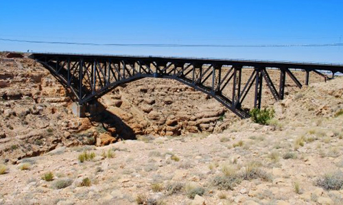 Canyon Diablo Bridge, June, 2009, courtesy Patrick Mansell. | 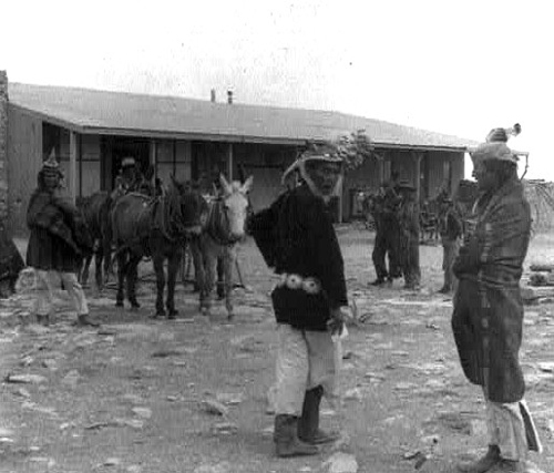 Canyon Diablo Navajo Trading Post in 1903. |
Canyon Diablo - Meaner Than Tombstone
Canyon Diablo, Arizona originated as a railroad town in 1880 when construction was halted until a bridge could be built over the canyon. A further delay was caused by financial difficulties and it wasn’t until 1890 that the railroad bridge was completed.
The canyon had earlier been given its name by a soldier named Lieutenant Whipple in 1853 when it presented such an obstacle to his thirty-fifth parallel survey party. Having to go miles out of their way to get across, he appropriately named it Devil’s Canyon. When the town was born, it took the canyon's name, which ended up being extremely appropriate for the reputation that the town would soon earn.
There being no law enforcement in the settlement, it quickly became a wild and lawless place as drifters, gamblers, and outlaws made their way to town. With the closest law enforcement being some 100 miles away, the settlement earned a reputation of being meaner than Tombstone and Dodge City combined, with many of it "citizens” winding up in the local cemetery. The saloons, gambling dens and brothels never closed, running 24 hours a day. The town comprised mostly of shacks with two lines of buildings facing each other across the rocky road on the north side of the railroad right-of-way. The "street,” aptly referred to as Hell Street, included fourteen saloons, ten gambling houses, four brothels and two dance halls. Wedged between these businesses were a couple of eating counters, a grocery and a dry goods store.
With a population of nearly 2,000, a regular stage operated between Flagstaff and Canyon Diablo that ended up being the target of many robberies. When Canyon Diablo finally got a peace officer, the first one pinned on a badge at 3:00 p.m. and was laid out for burial at 8:00 p.m. Five more foolish men also tried their hands at marshalling in this God forsaken town. None of them lasted more than a month in the position before they too were killed.
Boot Hill cemetery filled up fast, where at one time 35 graves could be seen with wooden markers and stone covered mounds. All are gone today, but that of Herman Wolf, a trader who passed away in 1899 and the only one to have died peacefully.
Once the railroad bridge was built over the canyon, the town began to die. Still wild, the remaining residents requested that the army take over law enforcement, but before they arrived the town was pretty much dried up and the lawless drifters had moved on.
Later when Route 66 came through the area, another town called Two Guns sprouted up almost on top of Canyon Diablo. Catering to the travelers of the Mother Road, Two Guns'buildings were built to the east and north of Canyon Diablo. Two Guns is also a ghost townthat died with the advent of I-40.Today, the ruins of the trading post, what is most likely the train depot, the grave of Herman Wolf, and several other stone buildings and foundations can be still be seen at Canyon Diablo. Canyon Diablo is south of I-40 between Meteor City, and Flagstaff, Arizona. Take the Two Guns Exit (#230). The road toCanyon Diablo is immediately right of the old gas station in Two Guns. This is a rough road and best traveled with a four wheel drive; however, if conditions are good, and you take your time, it could be taken in a regular car. The road is very rocky, so caution should be taken with any low seated vehicle. | |
© Kathy Weiser/Legends of America, updated July, 2010. Canyon Diablo Bridge, June, 2009, courtesy Patrick Mansell. | Canyon Diablo Navajo Trading Post in 1903. |
Subscribe to:
Comments (Atom)