Thursday, April 14, 2011

Lost Mines of California


Book your lodging right HERE online


Prospector Goldpanning
A prospector gold panning.
This image available for photographic prints
 and downloads HERE!

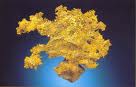
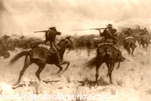
Once gold was discovered and the California Gold Rush began, more than 500 camps, villages and towns sprang up almost overnight as some 80,000 prospectors poured into the Mother Lode country in 1849 alone. For more than a decade, the flood of people continued to come,arriving overland on the California Trail, by ship around Cape Horn, or through the Panama shortcut. In the beginning, the miners easily gathered the surface gold, scratching more than $10 million from the land in 1849. By 1853 the yield had peaked at more than $81 million before dropping in 1855 to $55 million.

Among these tens of thousands of prospectors and an almost equal amount of claims, tales of "lost mines" began almost immediately as pioneers were killed, sickened, or lost their way back to many of the rich ore finds in the mountains and deserts of the Golden State.
Whether these tales of lost mines are fact or fiction, their legends are still alive for hopeful prospectors of California.
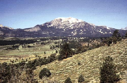
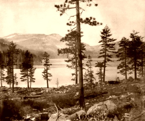
Cement Gold Mine of Mammoth Mountain
In 1857 two German men who had been traveling with a California-bound wagon train, left the rest of the group and headed out on their own. Winding up in the Mono Lake region of northern California, one of the men would later describe the area as "the burnt country." While crossing the Sierra Nevada near the headwaters of the Owens River, they sat down to rest near a stream. Here, they noticed a curious looking rock ledge of red lava filled with what appeared to be pure lumps of gold "cemented" together, hence, the name.

The ledge was so loaded with the ore that one of the men didn't believe it to be real, laughing at the other as he pounded away about ten pounds of the ore to take with him. The believer drew a map to the location and the two continued their journey. Along the way, the disbeliever died and the gold-laden traveler tossed the majority of the samples. After crossing the mountains, he followed the San Joaquin River to the mining camp of Millerton, California. During his journey, the German had become ill and soon went to San Francisco for treatment. He was diagnosed and cared for by a Dr. Randall who told the man he was terminally ill with consumption (tuberculosis). With no money to pay the doctor and too ill to return to the treasure, he paid his caretaker with the ore, the map he had drawn, and provided him with a detailed description.

Mammoth Mountain, California
Mammoth Mountain, courtesy U.S. Geological Survey
Dr. Randall shared this knowledge with a few of his friends and together they arrived at old Monoville in the spring of 1861. Engaging additional men to help, Randall's group began to prospect on a quarter-section of land called Pumice Flat. Thought to have been some eight miles north of Mammoth Canyon, the 120 acres were near what became known as Whiteman's Camp.
Word spread quickly and before long miners flooded the area hunting for the gold laden red "cement." One story tells that two of Dr. Randall's party had in fact found the "Cement Mine," taking several thousand dollars from the ledge. Unfortunately, for those two men, the area was rife with the Owens Valley Indian War which began in 1861.

The Paiute Indians, who had heretofore been generally peaceful, balked at the large numbers of prospectors who had invaded their lands. The two miners who had allegedly found the lost ledge were killed by the Indians before they were able to tell of its location.
Though the "cement" outcropping was never found, the many prospectors who flooded the eastern Sierra region did find gold, resulting in the mining camps of Dogtown, Mammoth City, Lundy Canyon, Bodie, and many others.
The lost lode is said to lie somewhere in the dense woods near the Sierra Mountain headwaters of the San Joaquin River's middle fork.


In 1894, Tom Scofield, a railroad worker, was surveying near the Clipper Mountains northwest of Essex, California when he decided to do a little exploring. When he was about three miles up the side of the mountain, he ran across an old abandoned stone house that appeared to have been built years previously.  Continuing along, he hiked approximately nine more miles when he came upon a spring. There, he followed a trail that led over the hill where he came upon a rock atop the peak that he described as being as big as a house. The large boulder was split in two and the trail continued straight through it. Beyond the passageway he stumbled into what appeared to be an old Spanish camp.

Clipper Mountains northwest of Essex, California
The Clipper Mountains are northwest of Essex, California
Tom found himself standing on a high shelf, surrounded by high walls. Through other openings in the rock walls, he could see that the "shelf” was sitting high above the ground at about 500 feet. The only way in or out of the little flat was through the split rock. Scattered about the long deserted camp, Scofield found rusty mining tools, pots, pans, fragments of a bedroll, and an old iron Dutch oven.
Also on the shelf was a mine shaft, in which he found the skeletons of seven burrows. Next to the shaft was a mine dump that contained numerous stones still containing rich gold quartz. By the time he had finished exploring the campsite, he realized that it was too late to return to his base camp. Cold and hungry, he bedded down on the shelf planning to leave at daybreak. In the morning, as he was leaving, he tripped over the Dutch oven and out tumbled a mound of pure gold nuggets. Shocked, Tom gathered as many nuggets as he could carry and returned to his base camp. From there he caught a train to Los Angeles, where he spent the next two months in a drunken frenzy, gambling and living the high life. After squandering all the money he had received from the sale of the gold nuggets, Scofield found himself sober and completely broke. It would be two years before he was able to make his way back to the Clipper Mountains to search for the "Dutch Oven Mine.”  Try as he might, it seemed to him that everything had changed and he was completely unable to retrace his steps. Disillusioned, he finally gave up the search.
When Scofield was 84, he was interviewed by Walter H. Miller and George Haight in 1936. Living in an abandoned store in the Mojave Desert outside Danby, California, Scofield was at first hesitant to tell his story. After having been hounded for four decades by treasure hunters wanting more information about the mine, he had long tired of the story even though he continued to insist that it was true.
Today, the Dutch Oven Mine continues to be lost, or at least no one has ever claimed to have found it.The Clipper Mountains are located in the Mojave Desert of southeastern California. The range is found just south of Interstate 40 and the Clipper Valley, between the freeway and National Old Trails Highway, northwest of the small community of Essex. The range is home to at least three springs, as well as the Tom Reed Mine.


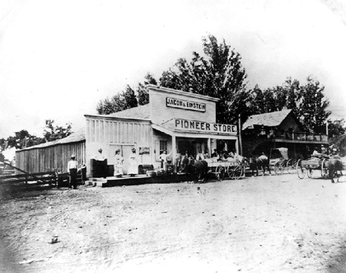
Goose Egg Mine of El Dorado County - As early as 1848, gold was found in the Mosquito Valley of El Dorado County, California. As more and more people found their way to the Gold Rush country, hundreds of mining camps sprung up all over the region. One that flourished was Newtown, some nine miles southeast of Placerville.

Established in 1852, Newtown was first settled by Swiss immigrants who spoke Italian and called the village "Sunny Italy.” Growing quickly, Newtown boasted a post office, several retail establishments and about 5,000 residents, with some claiming it was bigger than Placerville. Rich with placer gold, theWells Fargo Express began serving Newton three times a week and passenger stage routes were added later.


Gold Mining with a cradle
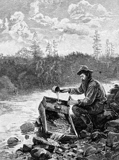
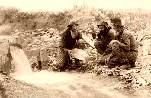
Using a cradle to find gold in 1883

Tales abounded of the easy gold to be found. On one occasion two large nuggets, one weighting 36 ounces and the other 42, were plucked from the South Fork of Webber Creek, one mile down stream from Newtown, in Pleasant Valley.
Into this midst of easy findings and quick fortunes came a young immigrant from Finland who went by the name of "Sailor Jack.” Though the naïve man knew absolutely nothing of gold mining, he was determined to make his fortune in the goldfields. No sooner had he come to town when several experienced miners, as a practical joke, convinced the newcomer to file a claim on a piece of land they knew to be worthless. But as fate will have it sometimes, the joke ended up being on the pranksters when Sailor Jack struck pay dirt on his claim and the mine became one of the richest in El Dorado County. Called theSailor Jack Mine, it was also known as the Pinchgut Mine, the One Spot Mine, and the Pinchemtight Mine. In its early days the placer mine, located about 1 ½ miles north of Newtown, yielded about $40,000 worth of gold.
It was during these frenzied days of working the Sailor Jack Mine that one of the miners employed there found yet another rich discovery. In a location above the Sailor Jack, in an area called Goose Neck Ravine, the miner found several large gold nuggets. Upon returning, he shared his discovery with several other miners who thought that the nuggets might have come from the lead source of the Sailor Jack. Though the prospector, as well as several others, returned to the area time after time, they could never find the spot where the nuggets were picked up. From that time on, the site has been referred to as the Lost Goose Egg Mine.
Today, there is nothing left of Newtown except an old stone building and a cemetery near the intersection of Newtown Road and Fort Jim Road about eight miles southeast of Placerville. The Sailor Jack Mine was located about 1 ½ miles due north of Newtown near today's Webber Reservoir.

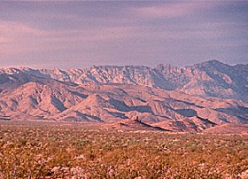
Gunsight Mine of Death Valley

Death Valley National Park
Death Valley Sand Dunes.
This image is available for photographic prints HERE.

In 1849, a group of California bound emigrants were headed out of Utah with a 107 wagons led by Captain Jefferson Hunt. However, by November, the group disagreed on the most direct route to the gold fields. Some believed there was a much shorter route across the desert, rather than taking the well known route along  the Old Spanish Trail. Though Hunt warned them that they were "walking into the jaws of hell,” several members of the group parted near Enterprise, Utah, believing the shortcut would save them about 20 days of travel.
They would become known as the "Lost 49’ers,” nearly starve on their journey, discover silver, and give the valley its name.

The splinter group consisted of several smaller parties, who would also disagree on the best way to cross the vast desert. Before reaching White Sage Flat, the party split once again, with one group hiking over the Panamint Mountains and the other traveling along the floor of the valley.
The two parties met up again at White Sage Flat, where one Jim Martin displayed silver ore that he had found while crossing the mountains. Exhausted, starved, and dehydrated, the group had little interest in mineral riches, focusing only on survival. After four months of travel across the vast desert lands, the tattered emigrants finally stumbled into Mariposa happily crying, "Good-bye, Death Valley."
During the terrible journey the pioneers had killed their oxen for meat, burned their wagons, and were forced to walk most of the way on what had become a "shortcut to hell.” In the meantime, the party who had stayed with Captain Hunt’s group had already arrived in California.
After settling in Jim Martin, who had lost the sight off his rifle during the journey, took the silver ore to a gunsmith who made it into a new gun sight. The story quickly spread, touching off one of the west’s great prospecting booms and the legend of the Lost Gunsight Mine.
One of the travelers, a Mr. Turner, who had been with Martin when he discovered the silver, decided to return to the desert in search of the silver. Failing to find it, he soon came upon a ranch belonging to Dr. E. Darwin French near Fort Tejon.  Telling the doctor the tale, French and Turner mounted a second expedition to search for the silver outcropping in September, 1850. They too were unsuccessful.
Though the "Lost Gunsight Mine” was never found, dozens of other prospectors were successful in finding hidden wealth in the Death Valley.


In the mid 1850’s prospectors were roaming the mountains and creeks of Siskiyou County along the northern boundary of California in search of their fortunes. Gold had been found in Humbug Creek as early as May, 1851 but a group of disillusioned miners dubbed the place as "humbug” when they failed to find any of the precious metal. However, that did not stop other prospectors from looking and a few years later when another group hit pay dirt, hundreds of miners flooded into what would be called the Humbug Mining District. Soon, a mining camp was formed  along the banks of Humbug Creek called Humbug City.


Mount Shasta in Siskiyou County, California
Siskiyou County, California, with Mount Shasta in the background, photo courtesy Welcome to California

It is near here that the Legend of the Lost Humbug Creek Mine began. When a man who was working for one of the Humbug District mines began to feel ill, he started to Yreka, some ten miles to the southeast to see a doctor. Shortly after coming upon the Deadwood Trail, he began to feel so ill that he lay down beneath a tree. As he looked around, spied a promising piece of quartz float and exploring further he found an entire outcropping. Suddenly felling better, he traveled some three or four miles back to his cabin, returning with a pick and shovel. He soon took out a sack full of gold that was estimated to have been worth $5,000 to $7,000. Excited to share the news, he soon traveled to Hawkinsville, where his parents and two brothers lived. Afterwards he returned to the site for more gold, when he began to feel sick once again. Leaving his pick and shovel, and covering the site with brush, he went to the county hospital where he died a week later.
Search as they might, his family was never able to find the site of their dead brother’s gold. The outcropping is said to be on the west side of the Humbug Mountains.
Long before the white settlers rushed into El Dorado County duringCalifornia's Gold Rush days, natives of the Hawaiian Islands had arrived here in the early 1800’s. These islanders, known as Kanakas, first worked the ships engaged in the hide and tallow trade before forming permanent settlements at a number of places in the Golden State. In El Dorado County, they lived in Kenao Village, named for their chief, and farmed the surrounding land.

The Hawaiians were one of first settlers to establish a town in El Dorado County, farming the land and living quietly before gold was discovered. However, when gold was discovered, they too joined the many miners flooding the area, as well as selling their produce to miners in Coloma. Before long, the miners began to call the village, Kanaka Town.

One of the Islanders by the name of "Kanaka Jack” soon appeared in the village, working a mine along Irish Creek, not far from town. Known to have brought large amounts of gold out of what became known as the Kanaka Jack Mine, he never told anyone of its exact location. In 1912, the Hawaiian miner died at the county hospital.

Today treasure hunters continue to search for the lost Kanaka Mine in El Dorado County.

Striking it Rich gold panning.
Striking it rich.
This image available for photographic prints and
 downloads HERE!

In the 1850’s several men from "back east” had come to the Golden State in search of their fortunes. While prospecting in Shasta County in northern California, they crossed the Sacramento River at Cow Creek about 2 ½ miles east of Fort Reading. From there, the prospectors followed another creek eastward for about thirty miles when they came upon a high waterfall. There, they found a rich gold deposit sitting above the waterfall. However, this was a dangerous time in the region as Indians, fed up with miners encroaching upon their lands, were often known to attack.  

Taking from the gold deposit what they could carry, the soon fled in fear of the natives. Returning to the Fort Reading, they asked for protection, but no troops could be spared. Soon, the men returned east from whence they came.
Years later, in the 1870’s, one of the men from this original group, along with his son-in-law, returned to the area in hopes of once again locating the waterfall. In Redding, he asked around about a creek with a high waterfall and was told there was one on Bear Creek near Inwood, some 25 miles to the southeast. The pair soon arrived in Inwood, telling their tale of the Lost Water Fall Mine and spending weeks exploring Bear Creek Canyon. However, after a long search, the two finally gave up and headed back east, never to be seen again.
Locals speculated that the country surrounding Inwood in primarily made up of volcanic rock and thought it an unlikely site for gold to have been found. More likely, many believed that the gold might have been found on another waterfall on Clover Creek about three miles from Oak Run and 25 miles east of Redding.

© Kathy Weiser/Legends of America, updated November, 2009.


 Hope you enjoyed the stories if so please visit my American Made Prospectors store and also join my blog today thanks , mike
Sacramento River in Shasta County, California
T

Thursday, April 7, 2011

More California Treasures Just Waiting To Be Found


Alameda County - With a posse on their tails in 1893, two banditsallegedly buried a cache of stolen loot near a brick kiln at Adams Point on Lake Merritt. When the lawmen caught up with the outlaws, one was killed and the other immediately arrested. The surviving outlaw died later died in prison. The ill-gotten treasure has never been found.

Contra Costa County - Dr. John Marsh, a California pioneer who was sometimes referred to as California's first American doctor, was allegedly known to bury his money near his home nestled in the foothills of Mt. Diablo.

Lake Merritt, California, from Adams Point, 1884
Lake Merritt from Adams Point, 1884, photo

Marsh was murdered in 1856 while on his way home from Martinez, without ever telling anyone of the exact location of his hidden riches. The treasure tale today alleges that Marsh had hidden a cache of some $40,000 gold coins near his home or Marsh Creek, that bears his name. Currently plans are under way to develop the location into a CaliforniaState Park.


Another, even larger treasure is said to be buried along the beaches of the county. In 1901, the Selby Smelter at Vallejo Junction was busy refining ores that were shipped from a number of neighboring mining districts.  But, one employee by the name of John Winters, was "busy” at a different task -- that of removing gold bars, one at a time from the vault, and burying them on the beach near the water’s edge. Taking an estimated $283,000 in gold, Winters was finally caught and about $130,000 of the bars were recovered. However, more than $150,000 remained lost.

Humboldt County - In July of 1928, the small post office at Willow Creek was robbed by two outlaws that escaped with some $2,800. According to the story, the bandits buried the loot in one of two places and never returned to retrieve it. The first version of its location tells of the stolen cache being buried near the Cedar Flat Bridge that crosses Trinity River about four miles upriver from Burnt Ranch. The second location has the loot hidden at some point up New River Canyon on the first ranch above the mouth of New River.

Another stolen cache, taken by an employee of the San Francisco Mint in 1894, is said to be buried in Humbolt County. The thief was later captured and sent to prison for his crime but refused to reveal the exact location of the loot. The treasure, containing some 290 pounds of gold ingots, is thought to be buried at Shelter Cove near Point Delgado.

Inyo County - Near Scotty's Castle in Death Valley, some say that a hidden cache of gold coins, amounting to as much as $200,000, was buried by Walter Scott. "Scotty," as he was more familiarly known, was a flamboyant and outrageous character, and a known swindler and prospector. Though he did not build or own the castle that bears his name, he was closely associated with the man that did.

Kings County - In 1873, the small town of Kingston, California was a stopping place on the Overland Stage route between Stockton and Visalia, California. In December of 1873,Tiburcio Vasquez and outlaw band made a bold raid, robbing the entire village and holding 39 men hostage. When an alarm was raised , the bandits dashed to their horses and began to flee. However, in the ensuing melee, three of the outlaws were shot and killed and the man carrying the stolen loot was wounded.

Kingston, California, 1879
Kingston, California is gone today but was thriving in 1870, photo
Unable to reach a horse, the injured bandit escaped on foot and made his way across the Kings River. Though theoutlaw was pursued, neither he nor the loot could be found. Years later, a skeleton was discovered in the area and was thought to have been the injured bandit, but again the ill-gotten cache remained unrecovered.

By the 1890's the town of Kingston had totally been abandoned and is completely gone today. The site of the town is now a California Historical Landmark (#270), which can be found in Kingston Park in the city of Hanford.

Marin County - Not all lost treasures of California are related to the Gold Rush. During the wild and wooly days of Prohibition, a German whiskey smuggler named Carl Hause was doing a brisk business. Hause's operations were located on Point Reyes Peninsula at the edge of Drake's Inlet just south of Inverness. The whiskey smuggler was said to have buried approximately $500,000 in gold-backed currency somewhere between Inverness and the old Heims Ranch. However, the liquor entrepreneur would not live to retrieve his ill-gotten gains as he was found shot to death in his car. The currency has never been found.


Modoc County - Though Modoc County was never known as prime mining country, a few treasure tales continue to be told in this region that is most known for its Indian lore and unparalleled scenic beauty.
In the last years of the 19th century a sheepherder picked up a heavy rock on the west slope of the South Warner Mountains. Forgetting about it for months, he finally retrieved the stone and took it to an assayer. Imagine his shock when he was told that the heavy rock was almost pure gold. He soon found an Alturas banker, who grubstaked him and the sheepherder returned to the Warner Mountains. However, try though he might, he searched relentlessly and was never able to find the source of ore again.

Another fairly well authenticated story tells of an Oregon emigrant who picked up a similar piece of rock in the 1850’s in the area of Devil's Garden. Though no mineral deposits of any amount were ever found in the area, the legend of hidden ore persists.

In the lava beds of northwest Modoc County a family was seeking refuge from a snowstorm some sixty years ago. While there, they said they found a rich copper vein in a crater of the rugged volcanic formations. Though Mr. Courtright and other prospectors returned to the area to search for the rich ore, it was never found.

During the 1860's an army scout by the name of Daniel Hoag was stationed at Fort Bidwell. While on a scouting trip into the Warner Mountains, in the area of Fandango Peak, he reportedly found a rich gold ledge. However, it was at this time that the area was in the midst of what is referred to as the Modoc Indian War. Hoag was killed in one of the battles before he was able to return to the site and the location of the ledge remains lost. Fort Bidwell, used from 1864 to 1892, is located on the Fort Bidwell Indian Reservation, where the officer's quarters continue to stand near the old post cemetery.

Nevada County - Several tales continue about the Donner Partyhaving buried their money during the time they were trapped during that terrible winter in 1846. One story tells that George Donnerallegedly buried about $10,000 in gold somewhere near Alder Creek northeast of Truckee, California. Though the cache has never been "officially" located, many believe that it was dug up and stolen afterDonner's death. Other members of the party are also said to have buried their savings in the area. This was supported when in May, 1891, a man named Edward Reynolds found a five-franc silver piece while fishing on the northeast corner of Donner Lake. A few days later, he and a friend returned to the site and found an entire sack of coins. The horde was believed to have been hidden by Elizabeth Graves.

San Luis Obispo County - There are numerous caves located through San Luis Obispo County that provided great cover for outlawsduring California's Wild West days. Near Avila Beach, a group ofbandits were said to have made one of these caves their hiding place where they hid much of there stolen cache. No additional information is available on the exact location of the cave.


Donner Lake, 1866,
Donner Lake, 1866,
This image available for photographic prints and downloads HERE!

Shasta County - Long ago, when a detachment of soldiers were transporting an Army payroll along the road between Redding and Weaverville, California, they were attacked by Indians. While the battle ranged, one soldier had the foresight to bury the gold and marked it by burying his rifle straight up in the ground. He then joined the rest of the soldiers in the frenzied battle.   Severely wounded, he was later rescued and taken to French Gulch where he told the story of the attack and buried payroll before he died. Though the army began an immediate search, they were unable to find the rifle or the hidden gold. Many years later, two deer hunters in the vicinity found the rifle and not knowing the story, removed it and took it with them. Today, French Gulch is a sleepy little village located about 10 miles east of Lewiston, California.

Tehama County – Peter Lassen was a pioneer and land owner in California long before its Gold Rush days of 1849. Arriving in 1840, he was able to secure a 26,000-acre land grant in 1843. Located in the upper Sacramento Valley, Lassen hoped to develop his land into an empire and established the Rancho Los Bosquejo, or the "ranch of the wooded places" in 1845. In the years that followed, Lassen developed a trading post, a new settlement, vineyards, and farms to entice people to what he believed would be his new empire. However, when gold was discovered at Sutter’s Mill in Coloma, his workers and settlers abandoned him for the goldfields. Lassen’s fortunes would rise and fall over the next decade until he was murdered in 1859 while traveling to Virginia City, Nevada to prospect for silver. Afterwards, a legend began to grow that Lassen had buried thousands of dollars in gold near his home on the Rancho Los Bosquejo. Located at the confluence of Deer Creek and the Sacramento River, he was said to have hidden his gold coins in iron pots surrounding his property. Though Lassen had a lifetime of financial difficulties, the legend continues. The buried cache is thought to be in Deer Creek Canyon near Vina,California or somewhere along the Lassen Trail which follows Deer Creek.

Some twenty years after Lassen's death, a miner named Obe Leininger found a gold-flecked ledge of gold in the same area. In order to find it again, he marked the spot by burying his pick in the trunk of a nearby tree. When he returned, however, he was unable to find the tree with the pick, though he searched the area diligently. Though he and others who had heard his tale continued to search the area for years afterwards, the gold ledge was never found again. The location of the ore was said to be to between the mouth of Calf Creek and the Potato Patch campground of the U.S. Forest Service, just beyond Deer Creek.

Trinity County - In the 1862, the sheriff of Trinity County was not only responsible for upholding the law, but was also tasked with collecting taxes. On one occasion as he was traveling through the area, his saddle bag was filled with about $1,000 in gold coins and $50 gold slugs. As the sheriff and his horse were cautiously crossing a stream, the horse stumbled and the saddlebag filled with gold was dropped and washed down the creek. Though the lawman made an immediate search of the area, he was unable to find the bag. Soon, the county offered a reward of $250 for the recovery of the saddle bag, but but despite diligent search efforts, including damming up the creek, it was never found. In those early days of California, gold slugs were often minted by assayers and private mines. Today, in addition to their gold value, they have also become major collectible items, and if the treasure were to be found today, some estimate it could be worth as much as a million dollars. The creek was located near Weaverville, California.

Yuba County - During California's Gold Rush days, a prospector by the name of Bill Snyder was one of the lucky ones. Working a claim along on of the branches of Oregon Creek on a ridge behind Camptonville, he consistently brought out large quantities of gold. Just as the gold was almost exhausted, Snyder became seriously ill and knowing he needed medical attention, he buried his gold, estimated at $30,000, between 2 large pine trees in the flat area below his cabin. He then left his cabin to seek a doctor. Though the type of illness is unknown, it was evidently very serious, as he was unable to return home for over a year. Imagine his distress when he returned to the site to find his cabin and the two large pine trees gone, replaced by a sawmill that now stood in its place. Only stumps of trees remained and though he searched diligently i the area, he was never able to locate his buried gold. He later died in the county home and to this day the hidden cache has never been found.

© Kathy Weiser/Legends of America, updated September, 2010.
If you enjoy these stories please visit my website for your prospecting needs.

Sunday, April 3, 2011

IDAHO LEGENDS Battle of Pierre's Hole


By Hiram Martin Chittenden, 1902

Pierre's Hole, as it was then called, or Teton Basin, its present name, is one of those valleys which are veritable oasis in the desert of rugged mountains. Very few of these valleys exceed that of Pierre's Hole in beauty. It is overhung on the east by that noble range of mountains whose culminating peak is the Grand Teton. The valley extends in a direction from southeast to northwest. It is fully thirty miles long and from five to fifteen miles wide. It appears like a broad, flat prairie almost destitute of trees except along its principal river and the various tributaries.

These typical mountain streams descend mostly from the Teton range, where they are fed by perennial snows and almost daily summer rains.

Pierre's Hole, Idaho
Pierre's Hole, Idaho, photo courtesy The Fur Trapper.com

The course of these streams can be traced for great distances by the ribbons of lush greenery which cross the plain here and there and unite with a larger line of trees along the central stream. These forests are more extensive than the observer from a distance would imagine. The more considerable cottonwood groves are often so filled with tangled growths of willows and creeping vines as to be almost impenetrable, and in many places it is a physical impossibility to get through them until the brush has been cut away. In the summer of 1832 the Rocky Mountain and American Fur Companies had their rendezvous in the upper part of the valley of Pierre's Hole some twelve or fifteen miles from Teton Pass. With their accustomed alacrity of movement, the managers of the RockyRocky Mountain Fur Company had excelled their rivals in reaching the rendezvous with their annual supplies. William L. Sublette arrived there with a party of about sixty men on July 6th. Nathaniel Wyeth was with him and so were the remnants of Jefferson Blackwell's and John Gannt's parties of the previous year whom Sublette had found on the Laramie River. Vanderburgh and Drips, of the American Fur Company, were also present. Lucien Fontenelle, who was coming from Fort UnionNorth Dakotawith supplies, was still far behind in the Bighorn Valley. Captain Benjamin Bonneville, likewise headed in the same direction, was still in the valley of the Platte River. In the valley of Pierre's Hole were also many hundreds of Indians, mostly of the Salish andNez Percé tribes. The Gros Ventre, ever hostile to the whites, were this year particularly troublesome around the headwaters of the Snake and Green Rivers. Although a post had been built in the Blackfoot country scarcely a year before -- Fort PieganMontana at the mouth of the Marias River -- this fact seems not at all to have tempered the ferocity of the tribe. They were at this time returning home from a visit to their kindred, the Arapaho.Sublette had had a sharp brush with them on the way to the rendezvous, and Thomas Fitzpatrick, who had gone on ahead, was unhorsed and forced to hide  in the mountains, and wandered for five days without food, reaching the rendezvous more dead than alive.
When the business of the rendezvous was nearly completed, a party of trappers under Milton G. Sublette set out on July 17th, in the direction of the main Snake River toward the southeast. Nathaniel Wyeth embraced this opportunity to secure a good escort out of theBlackfoot country for the remnant of his party who had decided to continue on to the Pacific Coast. The joint party proceeded just a short distance, six or eight miles, and encamped for the night. Just as they were setting out the next morning they discovered a party of horsemen approaching.
They were in doubt for a time whether it was white or Indian, but they soon found that it was a band of Gros Ventre. They were approaching in two parties, and numbered about a 150 men. According to Zenus Leonard, they carried a British flag which they had captured from a party of Hudson Bay trappers, whom they had recently defeated. The Indians came down into the valley with such fierceness that the trappers could not, at first, tell whether they were buffalo, white men or Indians. Finally, by the aid of Wyeth's looking glass, they discovered that there were also Blackfoot Indians, and Milton Sublette at once sent two men to the rendezvous for assistance.
Blackfoot Indians, 1913
This image available for photographic prints  and downloads HERE!

In the meantime, a tragedy of revenge had been enacting on the plain. The Blackfoot, discovering that the force before them was larger than they had supposed, made signs of peace, displaying, it is said, a white flag.

But, such was their general reputation for disloyalty that no confidence was placed in their friendly advances. There were, moreover, in the white camp two men who cherished inextinguishable hatred toward the Blackfoot. One of these was Antoine Godin, whose father had been murdered by theseIndians on Godin Creek. The other was a Salish chief whose nation had suffered untold wrongs from the tribe. When these two men advanced to meet the overtures of peace, a Blackfootchief came forward to meet them. By a previous arrangement made between Godin and the Salish chief, the latter shot theBlackfoot dead at the instant when Godin grasped his hand in friendship. Seizing the chief's scarlet robe, Godin and his companion beat a hasty, though safe, retreat.

The Indians then withdrew into some timber nearby, surrounded by a copse of willows, and immediately entrenched themselves by digging holes in the ground, and building a breastwork of timber in front of their rifle pits. This work was mostly done by the women, the Indians maintaining a skirmish line in front of the fort. While some of the men had gone to the rendezvous for reinforcements, Milton Sublette's trappers held the Indians within the woods, and Wyeth fortified his own camp, where he ordered his men to remain.
William L. Sublette and Robert Campbell, upon receiving the news of attack, immediately left the rendezvous and in short order, arrived on the field with a large force of whites and Indians.
Sublette assumed direction of the battle. He forbade bothWyeth's men and his own raw recruits to engage in the fight, and used only the seasoned trappers and the IndiansWyethhimself, however, was present in the engagement, part of the time. The Blackfoot, when they saw the overwhelming force with which they had to reckon, withdrew within their entrenchments.

The whites and allied Indians promptly commenced the attack by random firing into the thicket. This accomplished nothing, but gave the Blackfoot a chance to do some effective work in return. It was apparent that other measures would have to be adopted to dislodge them, and William L. Sublette proposed to storm the breastworks.  


Indian Fighters
Indian Fighters, Frederic Remington, 1907.

His men thought it too dangerous, but Subletteinsisted. About thirty of the whites and as manyIndians joined him, and together they entered the willow thickets. Pushing their way cautiously through the tangled shrubs, Sublette, Campbell, and Alexander Sinclair of Arkansas led the others toward the Indian "fort." Sublette and Campbell and doubtless others had made their wills to each other in anticipation of the consequences that might ensue. After working their way on hands and knees through the dense line of willows they came to more open ground, and then saw the rude fortification of the Indians. As they emerged into this open space they were more exposed to the fire of the BlackfootSinclair was killed on the spot andSublette was severely wounded. In the meantime,Wyeth with some Indians had gained nearly the opposite side of the fort, and one Indian near him was killed by a chance shot from Sublette's party. The besieged Indians suffered little at this time, for they were well protected, although completely overmatched in numbers.
The attack continued for the greater part of the day without any substantial progress, owing to the secure position of the enemy and the evident reluctance of the attackers to storm it. Finally, Sublette decided to burn them out, although much against the wishes of the friendlyIndians, who wanted to plunder the fort. A train of wood was laid and was about to be ignited, when an incident occurred which brought immediate relief to the beleaguered garrison. One of the friendly Indians, who understood the Blackfoot language held some conversation with the besieged during the fight. They now told him that they knew that the whites could kill them, but that they had 600-800 warriors who would soon arrive and who would give them all the fighting they wanted. In the process of interpretation, the Blackfootwas made to say that this force was then actually attacking the main rendezvous.
Such an attack would have been disastrous in the absence of the fighting force, and the whites, without waiting to verify the news, quickly hurried off to the rendezvous site. Before the mistake was discovered, it was too late to resume the attack. On the following morning the Blackfoot fort was found abandoned.
The casualties in this fight were, on the side of the whites were five killed, includingAlexander Sinclair, and six wounded, of whom William L. Sublette was one. The alliedIndians lost seven killed and six wounded. The loss of the Blackfoot was never fully known. They left nine dead warriors in the fort together with 25 horses and nearly all their baggage. Later, it was said that the Blackfoot admitted to having lost 26 warriors.
The Battle of Pierre's Hole was not without its important sequels. On July 25th, seven men of Wyeth's party, together with Alfred K. Stephens and four men, the joint party including a Mr. More of Boston, a Mr. Foy of Mississippi, and two grandsons of Daniel Boone, set out from the rendezvous to return East. They had intended to accompany William L. Sublette, but the latter's departure had been postponed about ten days on account of his wound. Impatient of the delay, these men set out to the eastward, and on the following day, were attacked in Jackson Hole by a band of some twenty Blackfoot. More and Foy were killed and Stephens was wounded. He, with the rest of the party, returned to the rendezvous, where he lingered until July 30th, when he died just after starting for St. Louis in company with William L. Sublette. His horses and traps were sold the same day, and his beaver fur was taken to St. Louis.
Sublette with his party of about 60 men and the furs they had collected over the past year left the  rendezvous on July 30th. The day after crossing the Snake River, on August 4th, they passed the large band of Blackfoot of whom they had been told by the Indian at the Battle of Pierre's Hole. These Indians had been hovering in the vicinity of the camps of Lucien Fontenelle and Benjamin Bonneville, but had not ventured to attack. In like manner, their recent experience in Pierre's Hole made them hesitate about attacking Sublette's party, and he was suffered to pass unmolested. This band of Indians finally left the country by the way of the Wind River Valley, where they were attacked and routed by some Crow Indians with a loss of 40 killed. The remainder were scattered like fugitives throughout the Crow country. It will be remembered that it was Antoine Godin who killed the Blackfoot chief at Pierre's Hole in revenge for the death of his father. But the account was not yet considered closed -- at least on the part of the Blackfoot. At some time between September, 1834 and September, 1835, the exact date unknown, a party of Blackfoot appeared on the opposite bank of the Snake River from Fort Hall. They were led by a desperado named James Bird, a former employee of the Hudson's Bay Company, who, having been made a prisoner by the Blackfoot, in a skirmish with some of that tribe, had remained with them and had become an influential chieftain. From the opposite side of the Snake River, Bird requested Godin to come across and buy their furs. Godin complied, not suspecting treachery. He sat down to smoke with the company, when Bird signaled to some Indians, who shot him in the back. While he was yet alive, Bird tore his scalp off and cut the letters " N.J.W.," Wyeth'sinitials, on his forehead. Thus ended the tragedy of Pierre's Hole.  
Compiled and edited by Kathy Weiser/Legends of America,January, 2010.


About the Author:  The Battle of Pierre's Hole written by Hiram Martin Chittenden and included in his book, The American Fur trade of the Far West, published in 1902. Chittenden served in the Corps of Engineers, eventually reaching the rank of Brigadier General. During this time, he was in charge of many notable projects including work at the Yellowstone and Yosemite National Parks,  and the Lake Washington Canal Project. He was also an author, penning historical volumes, tour guides, and poetry.

The story, as it appears here, is not verbatim as it has been edited for clarity and ease of the modern reader.
Hiram Martin Chittenden
Hiram Martin Chittenden (1858-1917)


Cute video watch it !

GoAnimate.com: wealth 4 all dinner by mrhall909

Like it? Create your own at GoAnimate.com. It's free and fun!